

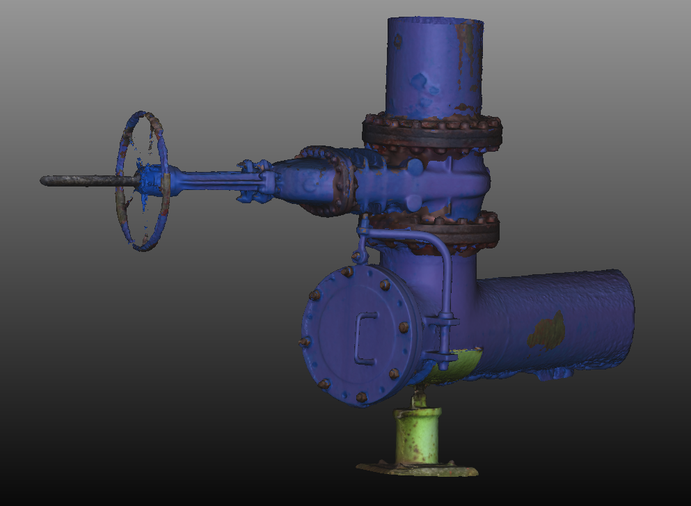
3D MODELING
ROAV7 3D modelizes industrial sites, facilities and equipment.
We use our UAVs and other sensors to collect data with which we realize 3D models by photogrammetry method.
The collected data are processed and analyzed to form a scatter plot. The latter is formed once every picture is aligned thanks to a plot-similarity search in order to replace them in 3D and get the intended result.
ROAV7 3D modelizes to measure, see a structure distortion and get a digital twin for maintenance monitoring, HSE training, shutdown preparation, etc.
To upload our study case, please fill up the following form :
SEE – ASSESS – DECIDE

No shutdown
No production loss
ROAV7 operates on your high-up areas without interrupting your activity.

Safer
Human risk decrease
Thanks to our UAV inspection, our clients can feel free of human factors from intervening and therefore reducing high-up work hours.

Faster
Remote intervention
ROAV7 can reach the elements of our clients’ interest within a few minutes of flight.

More accurate
Complete overview
ROAV7 collects exhaustive, clear and accurate data on the whole windmill facilities.